The Ecology team continued an active season of work across northern Arizona and the broader region, supporting field projects, remote‑sensing research, and partner collaborations.
Staff organized training for incoming students and seasonal technicians, continued multi‑site monitoring efforts, and advanced several research projects focused on fire behavior, post‑fire recovery, and forest‑structure assessment.
Field Projects and Monitoring
- Observatory Mesa Project — Remote‑sensing monitoring effort collecting pre‑ and post‑treatment lidar data for a thinning project near Lowell Observatory.
- Camp Navajo Project — Airborne and terrestrial LiDAR are being used to assess forest structure, fuel conditions, and wildfire hazard around the installation to support risk‑informed fuel treatment planning. Pre-thinning scans and plot data are being collected for post-treatment monitoring.
- Bryce Canyon National Park — ERI is using terrestrial and mobile lidar in Bryce Canyon National Park to collect detailed three-dimensional forest structure and fuels data that will provide park managers with high-resolution information to better understand forest conditions and wildfire hazard.
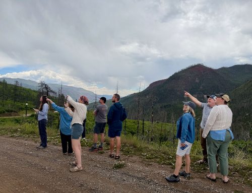
- Dragon Bravo & Warm Fire Field Trip — ERI researchers joined the Southwest Fire Science Consortium to discuss fuel‑treatment legacies, fire effects, and post‑fire restoration strategies in the 2025 Dragon Bravo and 2006 Warm Fire burn areas.
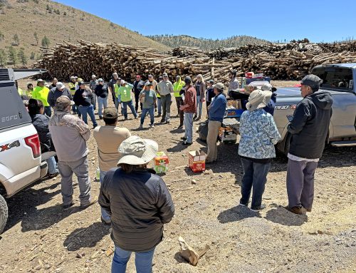
- Marshall Lake Project — Meag Dreher continues year two monitoring after mastication treatment, with crews collecting field and LiDAR data to assess chip and mastication fuels, understory response, and post‑treatment structure to inform fire behavior potential and long‑term maintenance need.
Research and Analysis
- Burn severity mapping — Kyle Rodman is finalizing work on remote‑sensing methods for assessing burn severity.
- Ignition modeling — Kyle is also working on a project related to predicting ignition locations and sources in central and southern Arizona.
- UAS multi‑party monitoring — Madi Litzenberger is leading analysis of UAS‑based monitoring across the 4FRI 2.4‑million‑acre footprint, including mechanical treatments and spring restoration sites.
- Lidar and UAS applications — ERI continues lidar‑ and UAS‑based remote‑sensing work under a USDA Forest Service agreement.
Professional Engagement
ForestSAT 2026 — In May, ERI staff attended the international conference that focuses on the application of remote sensing, geospatial technologies, and artificial intelligence in forestry and related fields.
North American Forest Ecology Workshop — In June, staff attended the workshop in Missoula, Montana, which featured plenary talks, scientific presentations, and field trips focused on building resilient forest ecosystems and communities.